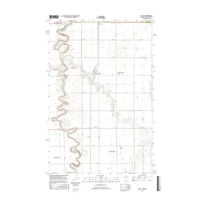
2016 Map of Shelly
USGS Topo · Published 2016About this map
Shelly sits along the complex oxbows of the Red River of the North, serving as a central point in this agricultural landscape on the Norman County and Polk County border. The river's serpentine course creates a natural boundary between North Dakota and Minnesota, where several smaller tributaries including the Goose River and the Marsh River converge with the primary waterway. The mapping reveals a distinct settlement pattern defined by section-line roads and numerous community burial grounds that anchor the rural landscape.
Find a feature on this map
29 named features on this map. Tap any name to fly to it.
Don’t see what you’re looking for? This feature index may not catch every label — zoom into the map to look around manually.
Map Details
Editions of this 2016 Shelly Map
This is the sole edition of this map. No revisions or reprints were ever made.
Other maps of this area

1918 · Hendrum
USGS Topo · 1:62,500

1919 · Eldred
USGS Topo · 1:62,500

1919 · Beltrami
USGS Topo · 1:62,500

1924 · Ada
USGS Topo · 1:62,500

1952 · Grand Forks
USGS Topo · 1:250,000

1956 · Grand Forks
USGS Topo · 1:250,000

1963 · Shelly
USGS Topo · 1:24,000

1963 · Halstad
USGS Topo · 1:24,000

1963 · Halstad SW
USGS Topo · 1:24,000

1964 · Beltrami SW
USGS Topo · 1:24,000