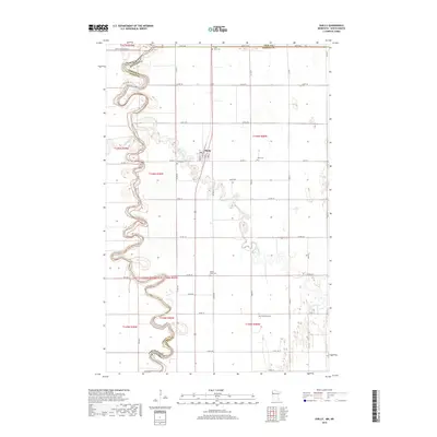
2019 Map of Shelly
USGS Topo · Published 2019About this map
The Red River of the North defines the winding border between Minnesota and North Dakota, carving deep oxbows through this fertile valley. At the center of this landscape lies Shelly, a hub connected by the intersection of Co Rd 3 and state routes. The hydrology of the region is complex, featuring the meandering Marsh River and the mouth of the Goose River, alongside engineered waterways like Mickelson Drain No 27. For those researching family history in the Red River Valley, this map identifies several local burial grounds including Saint Petri Cem, Zion Cem, Augustana Cem, and the Marsh River Cem. The distribution of these cemeteries across the rural townships illustrates the dispersed settlement patterns common in Norman County's agricultural history.
Find a feature on this map
39 named features on this map. Tap any name to fly to it.
Don’t see what you’re looking for? This feature index may not catch every label — zoom into the map to look around manually.
Map Details
Editions of this 2019 Shelly Map
This is the sole edition of this map. No revisions or reprints were ever made.
Other maps of this area

1918 · Hendrum
USGS Topo · 1:62,500

1919 · Eldred
USGS Topo · 1:62,500

1919 · Beltrami
USGS Topo · 1:62,500

1924 · Ada
USGS Topo · 1:62,500

1952 · Grand Forks
USGS Topo · 1:250,000

1956 · Grand Forks
USGS Topo · 1:250,000

1963 · Shelly
USGS Topo · 1:24,000

1963 · Halstad
USGS Topo · 1:24,000

1963 · Halstad SW
USGS Topo · 1:24,000

1964 · Beltrami SW
USGS Topo · 1:24,000