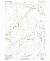
1962 Map of Shelton NE
USGS Topo · Published 1990About this map
Cairo sits at the northern edge of this Hall County landscape, a rural agricultural expanse defined by the parallel courses of Prairie Creek, Silver Creek, and Dry Creek. The land is organized into the townships of Mayfield, Harrison, Cameron, and South Loup, reflecting a dense network of early rural education and community infrastructure. Evidence of this settled past is found at Berwick Cem and several rural schoolhouses, including Plainview Sch, School No 31, and School No 76.
Find a feature on this map
19 named features on this map. Tap any name to fly to it.
Don’t see what you’re looking for? This feature index may not catch every label — zoom into the map to look around manually.
Map Details
Editions of this 1962 Shelton NE Map
3 editions found
Other maps of this area

1892 · Grand Island
USGS Topo · 1:62,500

1895 · Grand Island
USGS Topo · 1:62,500

1895 · Wood River
USGS Topo · 1:62,500

1896 · Wood River
USGS Topo · 1:125,000

1898 · Grand Island
USGS Topo · 1:125,000

1899 · Loup
USGS Topo · 1:125,000

1899 · St. Paul
USGS Topo · 1:125,000

1953 · Dannebrog
USGS Topo · 1:24,000

1953 · Boelus
USGS Topo · 1:24,000

1955 · Broken Bow
USGS Topo · 1:250,000