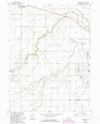
1962 Map of Shelton NE
USGS Topo · Published 1993About this map
The Cornhusker Ordnance Plant dominates the eastern landscape of Hall County in this mid-century topographic record, reflecting the significant industrial and military footprint in the region during the post-war era. To the west, the village of Cairo serves as a local hub, while the surrounding rural landscape is defined by the winding paths of Prairie Creek, Silver Creek, and Dry Creek. This survey provides a look at the social and civic infrastructure of the agricultural townships of Mayfield, Harrison, and Cameron, preserving the locations of rural schoolhouses like School No 31, School No 37, and Plainview Sch. The presence of the Berwick Cem and the Cornhusker State Wildlife Mgmt Area illustrates a varied land use pattern that balances historical rural life with larger government installations and conservation efforts.
Find a feature on this map
17 named features on this map. Tap any name to fly to it.
Don’t see what you’re looking for? This feature index may not catch every label — zoom into the map to look around manually.
Map Details
Editions of this 1962 Shelton NE Map
3 editions found
Other maps of this area

1892 · Grand Island
USGS Topo · 1:62,500

1895 · Grand Island
USGS Topo · 1:62,500

1895 · Wood River
USGS Topo · 1:62,500

1896 · Wood River
USGS Topo · 1:125,000

1898 · Grand Island
USGS Topo · 1:125,000

1899 · Loup
USGS Topo · 1:125,000

1899 · St. Paul
USGS Topo · 1:125,000

1953 · Dannebrog
USGS Topo · 1:24,000

1953 · Boelus
USGS Topo · 1:24,000

1955 · Broken Bow
USGS Topo · 1:250,000