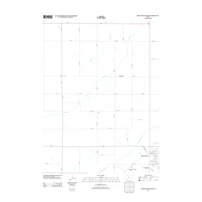
2013 Map of Shenandoah West
USGS Topo · Published 2013About this map
Shenandoah anchors the southeast corner of this western Page County landscape, where the residential grid meets the expansive agricultural reaches of southwestern Iowa. The E Nishnabotna River winds through the southern portion of the map, carving a path through the predominantly rectangular survey of country roads and section lines. This 2013 survey illustrates the sparse, rural nature of the region, punctuated by small named localities such as Farmer City, Corey, and Summit. These locations represent the enduring settlement patterns of the tallgrass prairie era, even as modern infrastructure like the Shenandoah Municipal Airport and the Fiftyliner Motel and Campgrounds serve contemporary travelers. Tributaries including Walnut Cr, Honey Cr, and Hunter Br drain the rolling farmland, while a network of numbered avenues and streets like Co Hwy-J26 and 120th St connect the isolated farmsteads that define the area's social and economic character.
Find a feature on this map
49 named features on this map. Tap any name to fly to it.
Don’t see what you’re looking for? This feature index may not catch every label — zoom into the map to look around manually.
Map Details
Editions of this 2013 Shenandoah West Map
This is the sole edition of this map. No revisions or reprints were ever made.
Other maps of this area

1939 · Farragut
USGS Topo · 1:62,500

1939 · Hamburg
USGS Topo · 1:62,500

1940 · Farragut
USGS Topo · 1:62,500

1941 · Hamburg
USGS Topo · 1:62,500

1955 · Nebraska City
USGS Topo · 1:250,000

1957 · Nebraska City
USGS Topo · 1:250,000

1957 · Randolph
USGS Topo · 1:24,000

1957 · Tabor NE
USGS Topo · 1:24,000

1958 · Nebraska City
USGS Topo · 1:250,000

1978 · Shenandoah East
USGS Topo · 1:24,000