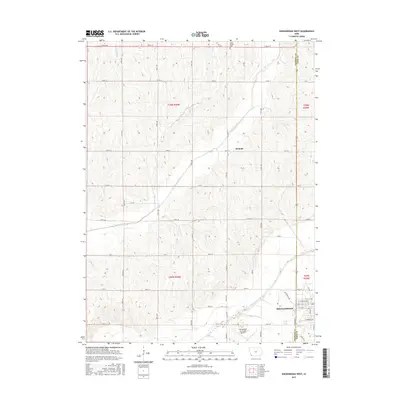
2015 Map of Shenandoah West
USGS Topo · Published 2015About this map
The Shenandoah city limits and the adjacent township borders of Page and Fremont counties define this agricultural landscape in Southwest Iowa. The western edge of the city is detailed with a grid of residential and industrial streets, including W Sheridan Ave, W Valley Ave, and 5th Ave. South of the urban center, the Shenandoah Municipal Airport sits near the winding course of the East Nishnabotna River, while the small settlement of Summit remains a distinct point on the uplands to the north.
Find a feature on this map
52 named features on this map. Tap any name to fly to it.
Don’t see what you’re looking for? This feature index may not catch every label — zoom into the map to look around manually.
Map Details
Editions of this 2015 Shenandoah West Map
This is the sole edition of this map. No revisions or reprints were ever made.
Other maps of this area

1939 · Farragut
USGS Topo · 1:62,500

1939 · Hamburg
USGS Topo · 1:62,500

1940 · Farragut
USGS Topo · 1:62,500

1941 · Hamburg
USGS Topo · 1:62,500

1955 · Nebraska City
USGS Topo · 1:250,000

1957 · Nebraska City
USGS Topo · 1:250,000

1957 · Randolph
USGS Topo · 1:24,000

1957 · Tabor NE
USGS Topo · 1:24,000

1958 · Nebraska City
USGS Topo · 1:250,000

1978 · Shenandoah East
USGS Topo · 1:24,000