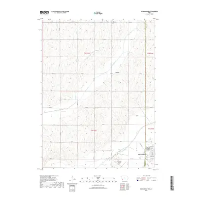
2018 Map of Shenandoah West
USGS Topo · Published 2018About this map
Shenandoah sits at the eastern edge of this quadrangle, where the grid of city streets like W Sheridan Ave and W Nishna Rd meets the open agricultural landscape of the Fremont and Page County line. The terrain is defined by the winding course of the East Nishnabotna River, which flows past the Shenandoah Municipal Airport in the southeastern corner. Further north, the small community of Summit occupies a high point near the headwaters of Walnut Creek. The landscape is etched with a precise network of sectional roads such as Co Rd M16 and 120th St, which connect dispersed rural landmarks like Mount Calvary Cem. This 2018 survey illustrates the persistent importance of the river valley and the ridge-line settlements in Southwest Iowa's farming country.
Find a feature on this map
38 named features on this map. Tap any name to fly to it.
Don’t see what you’re looking for? This feature index may not catch every label — zoom into the map to look around manually.
Map Details
Editions of this 2018 Shenandoah West Map
This is the sole edition of this map. No revisions or reprints were ever made.
Other maps of this area

1939 · Farragut
USGS Topo · 1:62,500

1939 · Hamburg
USGS Topo · 1:62,500

1940 · Farragut
USGS Topo · 1:62,500

1941 · Hamburg
USGS Topo · 1:62,500

1955 · Nebraska City
USGS Topo · 1:250,000

1957 · Nebraska City
USGS Topo · 1:250,000

1957 · Randolph
USGS Topo · 1:24,000

1957 · Tabor NE
USGS Topo · 1:24,000

1958 · Nebraska City
USGS Topo · 1:250,000

1978 · Shenandoah East
USGS Topo · 1:24,000