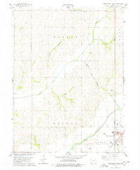
1978 Map of Shenandoah West
USGS Topo · Published 1978About this map
The western edges of Shenandoah anchor this late-1970s survey, where the developing city meets the agricultural heart of the Fremont and Page County border. The local economy and infrastructure are clearly defined by the confluence of the Nishnabotna River and major rail lines, including the Norfolk and Western and Burlington Northern corridors. This period captures the town's expansion with residential features like the Trailer Park and educational facilities such as the Lowell Ave Sch.
Find a feature on this map
26 named features on this map. Tap any name to fly to it.
Don’t see what you’re looking for? This feature index may not catch every label — zoom into the map to look around manually.
Map Details
Editions of this 1978 Shenandoah West Map
This is the sole edition of this map. No revisions or reprints were ever made.
Other maps of this area

1939 · Farragut
USGS Topo · 1:62,500

1939 · Hamburg
USGS Topo · 1:62,500

1940 · Farragut
USGS Topo · 1:62,500

1941 · Hamburg
USGS Topo · 1:62,500

1955 · Nebraska City
USGS Topo · 1:250,000

1957 · Nebraska City
USGS Topo · 1:250,000

1957 · Randolph
USGS Topo · 1:24,000

1957 · Tabor NE
USGS Topo · 1:24,000

1958 · Nebraska City
USGS Topo · 1:250,000

1978 · Shenandoah East
USGS Topo · 1:24,000