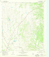
1967 Map of Shep
USGS Topo · Published 1969About this map
Shep and Happy Valley anchor this West Texas landscape during the late 1960s, a period marked by extensive petroleum extraction and land management. The terrain is defined by a dense network of drainage systems, including Spring Creek, Bluff Creek, and the various forks of the Elm Creek watershed, which carve through the plateau toward Flat Top Mountain. The map reveals a working landscape where numerous Oil Wells and Gravel Pits are interspersed with cattle country infrastructure. Local history and genealogy are preserved at the Shep Cem and Bluff Creek Cem, while modern utility developments are represented by a Pumping Sta, a Substa, and several strategically placed radio towers. Significant elevation markers like Horse Hollow and specific spillway levels offer a precise record of the hydrological engineering that supported this rural Taylor County community.
Find a feature on this map
29 named features on this map. Tap any name to fly to it.
Don’t see what you’re looking for? This feature index may not catch every label — zoom into the map to look around manually.
Map Details
Editions of this 1967 Shep Map
2 editions found
Other maps of this area

1890 · Abilene
USGS Topo · 1:125,000

1892 · Abilene
USGS Topo · 1:125,000

1893 · Sweetwater
USGS Topo · 1:125,000

1954 · Big Spring
USGS Topo · 1:250,000

1954 · Abilene
USGS Topo · 1:250,000

1957 · Merkel
USGS Topo · 1:62,500

1957 · Buffalo Gap
USGS Topo · 1:62,500

1958 · Big Spring
USGS Topo · 1:250,000

1958 · Abilene
USGS Topo · 1:250,000

1967 · Hylton
USGS Topo · 1:24,000