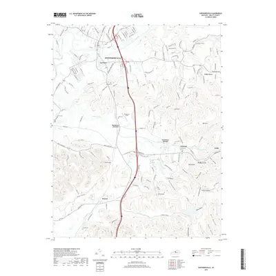
2019 Map of Shepherdsville
USGS Topo · Published 2019About this map
Shepherdsville serves as the focal point of this Kentucky landscape, situated where the Salt River meets a complex network of tributaries like Long Lick Creek and Lickskillet Creek. The town's grid is bisected by the CSX railroad and modern transit corridors, yet the surrounding hills maintain a distinct character defined by family-named landmarks and hollows. Local genealogy is well-supported by numerous burial sites, including the Maraman Cemetery and Smith Cemetery near Bardstown Junction, as well as the Lee Cemetery and Cundiff Cemetery further south near Belmont.
Find a feature on this map
174 named features on this map. Tap any name to fly to it.
Don’t see what you’re looking for? This feature index may not catch every label — zoom into the map to look around manually.
Map Details
Editions of this 2019 Shepherdsville Map
This is the sole edition of this map. No revisions or reprints were ever made.
Other maps of this area

1907 · Louisville
USGS Topo · 1:62,500

1909 · Kosmosdale
USGS Topo · 1:48,000

1912 · Kosmosdale
USGS Topo · 1:62,500

1936 · Vine Grove
USGS Topo · 1:62,500

1943 · Vine Grove
USGS Topo · 1:62,500

1946 · Pitts Point
USGS Topo · 1:24,000

1946 · Colesburg
USGS Topo · 1:24,000

1946 · Vine Grove
USGS Topo · 1:62,500

1949 · Cravens
USGS Topo · 1:24,000

1949 · Shepherdsville
USGS Topo · 1:24,000