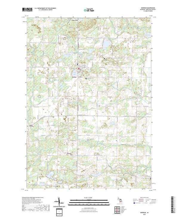
2023 Map of Sheridan
USGS Topo · Published 2023About this map
Sheridan serves as the primary hub of this Montcalm County landscape, where small-town streets like Washington St and St Clair St meet near the shores of Pearl Lake. The surrounding countryside is defined by its glacial hydrology, featuring numerous named water bodies such as Holland Lake, Rosa Lake, and Snow Lake. The pattern of rural life is visible in the scattered communities of Fenwick and Amsden, connected by a network of county roads. For those tracing family histories, the area is well-served by local landmarks including Sheridan Cem, Evergreen Township Cem, and the Evergreen Township Hall. Agricultural land use is evident throughout the townships, with the Farm Service Agency Interest of Michigan noting specific tracts of interest, while the Minikey Airport provides a small aviation facility amidst the fields and woodlots.
Find a feature on this map
64 named features on this map. Tap any name to fly to it.
Don’t see what you’re looking for? This feature index may not catch every label — zoom into the map to look around manually.
Map Details
Editions of this 2023 Sheridan Map
This is the sole edition of this map. No revisions or reprints were ever made.
Other maps of this area

1954 · Midland
USGS Topo · 1:250,000

1958 · Midland
USGS Topo · 1:250,000

1959 · Midland
USGS Topo · 1:250,000

1964 · Langston
USGS Topo · 1:24,000

1964 · Stanton
USGS Topo · 1:24,000

1965 · Crystal
USGS Topo · 1:24,000

1966 · Midland
USGS Topo · 1:250,000
1967 · Palo
USGS Topo · 1:24,000
1967 · Butternut
USGS Topo · 1:24,000
1972 · Belding
USGS Topo · 1:24,000