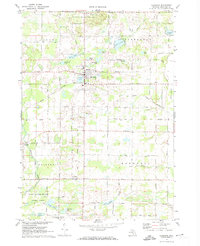
1972 Map of Sheridan
USGS Topo · Published 1974About this map
Sheridan serves as the central hub for this portion of Montcalm County, situated at the junction of the Grand Trunk Western railroad and several primary local arteries like Condensery Road. The landscape is a mosaic of small glacial lakes and agricultural land, with Pearl Lake and Mitchell Lake bordering the town's western edge. The map reveals a deeply rooted rural community, marked by numerous small churches and burial grounds including Evergreen Ch, Township Cem, and the United Brethren Ch near Fenwick.
Find a feature on this map
56 named features on this map. Tap any name to fly to it.
Don’t see what you’re looking for? This feature index may not catch every label — zoom into the map to look around manually.
Map Details
Editions of this 1972 Sheridan Map
This is the sole edition of this map. No revisions or reprints were ever made.
Other maps of this area

1954 · Midland
USGS Topo · 1:250,000

1958 · Midland
USGS Topo · 1:250,000

1959 · Midland
USGS Topo · 1:250,000

1964 · Langston
USGS Topo · 1:24,000

1964 · Stanton
USGS Topo · 1:24,000

1965 · Crystal
USGS Topo · 1:24,000

1966 · Midland
USGS Topo · 1:250,000
1967 · Palo
USGS Topo · 1:24,000
1967 · Butternut
USGS Topo · 1:24,000
1972 · Belding
USGS Topo · 1:24,000