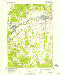
1956 Map of Sheridan
USGS Topo · Published 1956About this map
The South Yamhill River valley serves as a bustling industrial corridor in the mid-1950s, anchoring the timber and transit hubs of Sheridan and Willamina. This survey captures the region just as the modern road network was taking its permanent shape, with sections of the Salmon River Highway and Dallas Coast Highway marked as under construction. Large millponds reflect the heavy reliance on the lumber industry, while the Southern Pacific and Longview Portland and Northern railroads provide the essential logistical links to the broader Oregon market.
Find a feature on this map
38 named features on this map. Tap any name to fly to it.
Don’t see what you’re looking for? This feature index may not catch every label — zoom into the map to look around manually.
Map Details
Editions of this 1956 Sheridan Map
4 editions found
Other maps of this area

1942 · Sheridan
USGS Topo · 1:62,500

1942 · Spirit Mtn
USGS Topo · 1:62,500

1942 · Valsetz
USGS Topo · 1:62,500

1942 · Dallas
USGS Topo · 1:62,500

1948 · Vancouver
USGS Topo · 1:250,000

1950 · Vancouver
USGS Topo · 1:250,000

1950 · Vancouver
USGS Topo · 1:250,000

1953 · Salem
USGS Topo · 1:250,000

1954 · Salem
USGS Topo · 1:250,000

1955 · Grand Ronde
USGS Topo · 1:62,500