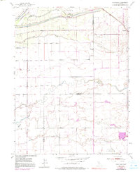
1953 Map of Sheridan
USGS Topo · Published 1991About this map
The Bear River defines the northern landscape of this region where Yuba, Sutter, and Placer Counties converge. In the early 1950s, the area around the settlement of Sheridan is characterized by its complex network of waterways, including Yankee Slough, Coon Creek, and Markham Ravine. The map reveals the historical footprints of the Johnson Grant Rancho Boundary, which overlays the section lines, and a large Military Reservation situated in the southeast corner.
Find a feature on this map
21 named features on this map. Tap any name to fly to it.
Don’t see what you’re looking for? This feature index may not catch every label — zoom into the map to look around manually.
Map Details
Editions of this 1953 Sheridan Map
4 editions found
Other maps of this area

1888 · Marysville
USGS Topo · 1:125,000

1888 · Smartsville
USGS Topo · 1:125,000

1891 · Sacramento
USGS Topo · 1:125,000

1891 · Marysville
USGS Topo · 1:125,000

1891 · Smartsville
USGS Topo · 1:125,000

1892 · Sacramento
USGS Topo · 1:125,000

1892 · Smartsville
USGS Topo · 1:125,000

1893 · Sacramento
USGS Topo · 1:125,000

1894 · Smartsville
USGS Topo · 1:125,000

1894 · Marysville
USGS Topo · 1:125,000