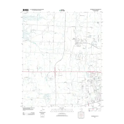
2013 Map of Sherman NW
USGS Topo · Published 2013About this map
Sherman Oil Field dominates the eastern landscape of this Grayson County region, illustrating the industrial footprint of petroleum extraction alongside the suburban expansion of northwest Sherman. Aviation is a defining characteristic of this area, anchored by the expansive North Texas Regional Airport/Perrin Field and supported by numerous smaller landing strips like Butler Airport and LM Ranch Airport. These facilities reflect the area's transition from traditional agricultural use to a modern transportation and energy hub.
Find a feature on this map
129 named features on this map. Tap any name to fly to it.
Don’t see what you’re looking for? This feature index may not catch every label — zoom into the map to look around manually.
Map Details
Editions of this 2013 Sherman NW Map
This is the sole edition of this map. No revisions or reprints were ever made.
Other maps of this area

1901 · Denison
USGS Topo · 1:125,000

1954 · Sherman
USGS Topo · 1:250,000

1957 · Denison Dam
USGS Topo · 1:24,000

1958 · Dorchester
USGS Topo · 1:24,000

1958 · Gordonville
USGS Topo · 1:62,500

1958 · Denison Dam
USGS Topo · 1:62,500

1958 · Sherman NW
USGS Topo · 1:24,000

1958 · Whitesboro
USGS Topo · 1:62,500

1958 · Sherman
USGS Topo · 1:250,000

1958 · Sherman
USGS Topo · 1:62,500