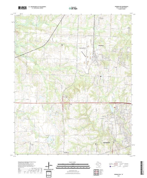
2022 Map of Sherman NW
USGS Topo · Published 2022About this map
The growing boundaries of Sherman and Denison define this North Texas landscape, where suburban expansion meets legacy agricultural and aviation infrastructure. A concentration of regional transport hubs, including the North Texas Regional Airport/Perrin Field and Butler Airport, highlights the area's transition from a rural farming district to a modern aviation and education center. For local historians, the preservation of numerous small burial sites like Enterprise Cem, Offutt Cem, and the Grayson County Farm Cem provides a tangible link to the families who settled this portion of Grayson County. The map details the drainage patterns of Harris Creek and Post Oak Creek, illustrating how the terrain was partitioned by early land grants and later by the development of Grayson College and evolving road networks like Refuge Rd and Plainview Rd.
Find a feature on this map
135 named features on this map. Tap any name to fly to it.
Don’t see what you’re looking for? This feature index may not catch every label — zoom into the map to look around manually.
Map Details
Editions of this 2022 Sherman NW Map
This is the sole edition of this map. No revisions or reprints were ever made.
Other maps of this area

1901 · Denison
USGS Topo · 1:125,000

1954 · Sherman
USGS Topo · 1:250,000

1957 · Denison Dam
USGS Topo · 1:24,000

1958 · Dorchester
USGS Topo · 1:24,000

1958 · Gordonville
USGS Topo · 1:62,500

1958 · Denison Dam
USGS Topo · 1:62,500

1958 · Sherman NW
USGS Topo · 1:24,000

1958 · Whitesboro
USGS Topo · 1:62,500

1958 · Sherman
USGS Topo · 1:250,000

1958 · Sherman
USGS Topo · 1:62,500