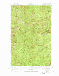
1948 Map of Sherman Peak
USGS Topo · Published 1976About this map
Colville National Forest dominates this topographic study of the Kettle River Range in the late 1940s. The landscape is defined by its series of high peaks and ridges, including the prominent Sherman Pk and the lookout at Copper Butte, providing a detailed look at the watershed before modern forest management changed the backcountry. This era is captured through the lens of remote outposts such as Snowshoe Camp and the Growden Guard Sta, which anchored the administrative and recreational life of the high country.
Find a feature on this map
53 named features on this map. Tap any name to fly to it.
Don’t see what you’re looking for? This feature index may not catch every label — zoom into the map to look around manually.
Map Details
Editions of this 1948 Sherman Peak Map
2 editions found
Other maps of this area

1904 · Republic
USGS Topo · 1:125,000

1936 · Marcus
USGS Topo · 1:96,000

1942 · Marcus
USGS Topo · 1:125,000

1948 · Curlew
USGS Topo · 1:62,500

1948 · Republic
USGS Topo · 1:62,500

1948 · Sherman Peak
USGS Topo · 1:62,500

1948 · Kettle Falls
USGS Topo · 1:62,500

1948 · Orient
USGS Topo · 1:62,500

1948 · Togo Mountain
USGS Topo · 1:62,500

1950 · Inchelium
USGS Topo · 1:62,500