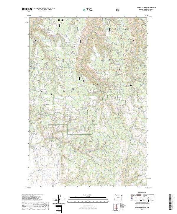
2023 Map of Sherod Meadows
USGS Topo · Published 2023About this map
Wallowa National Forest land dominates this high-elevation landscape, where a network of ridges and springs defines the drainage patterns into the northern canyonlands. The map reveals a remote geography of named timber and grazing lands, from McAllister Ridge in the east to the prominent Deer Ridge in the north. Settlement is nearly absent, save for the clearing at Sherod Meadows, which serves as a central landmark amidst the complex topography of Minor Gulch and Simmons Draw.
Find a feature on this map
78 named features on this map. Tap any name to fly to it.
Don’t see what you’re looking for? This feature index may not catch every label — zoom into the map to look around manually.
Map Details
Editions of this 2023 Sherod Meadows Map
This is the sole edition of this map. No revisions or reprints were ever made.
Other maps of this area

1955 · Grangeville
USGS Topo · 1:250,000

1957 · Sled Springs
USGS Topo · 1:62,500

1959 · Grangeville
USGS Topo · 1:250,000

1964 · Akers Butte
USGS Topo · 1:24,000

1964 · Wallowa
USGS Topo · 1:24,000

1967 · Wood Butte
USGS Topo · 1:24,000
1967 · Shamrock Creek
USGS Topo · 1:24,000

1967 · Promise
USGS Topo · 1:24,000

1982 · Wallowa
USGS Topo · 1:100,000
1984 · Akers Butte
USGS Topo · 1:24,000