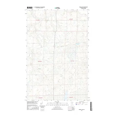
2016 Map of Sherry Lake
USGS Topo · Published 2016About this map
Sherry Lake and the surrounding Itasca County wetlands dominate this landscape, illustrating the intricate drainage patterns of Northern Minnesota's forest country. The map highlights a complex network of moving and standing water, notably the Louis Peloquin Wildlife Impoundment Reservoir and the winding course of Stony Brook. These features, along with Bear River and Venning Creek, define a terrain where topography is subtly shaped by glacial history and modern conservation efforts.
Find a feature on this map
17 named features on this map. Tap any name to fly to it.
Don’t see what you’re looking for? This feature index may not catch every label — zoom into the map to look around manually.
Map Details
Editions of this 2016 Sherry Lake Map
This is the sole edition of this map. No revisions or reprints were ever made.
Other maps of this area

1919 · Release
USGS Topo · 1:62,500

1943 · Release
USGS Topo · 1:62,500

1954 · Hibbing
USGS Topo · 1:250,000

1957 · Hibbing
USGS Topo · 1:250,000

1958 · Hibbing
USGS Topo · 1:250,000

1964 · Hibbing
USGS Topo · 1:250,000

1964 · Side Lake
USGS Topo · 1:24,000
1964 · Stingy Lake
USGS Topo · 1:24,000

1964 · Sherry Lake
USGS Topo · 1:24,000
1964 · O'Leary Lake
USGS Topo · 1:24,000