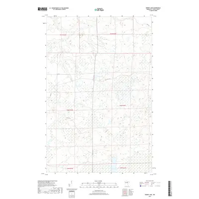
2019 Map of Sherry Lake
USGS Topo · Published 2019About this map
Sherry Lake sits at the southern edge of this northern landscape, which is defined by an extensive network of wetlands and small watercourses. The northern reaches are drained by the Bear River and Stony Brook, while Venning Cr meanders through the central sections toward Wamp Lake. This remote portion of Itasca County is accessible via a handful of designated routes such as Co Hwy 52 and Co Rd 552.
Find a feature on this map
16 named features on this map. Tap any name to fly to it.
Don’t see what you’re looking for? This feature index may not catch every label — zoom into the map to look around manually.
Map Details
Editions of this 2019 Sherry Lake Map
This is the sole edition of this map. No revisions or reprints were ever made.
Other maps of this area

1919 · Release
USGS Topo · 1:62,500

1943 · Release
USGS Topo · 1:62,500

1954 · Hibbing
USGS Topo · 1:250,000

1957 · Hibbing
USGS Topo · 1:250,000

1958 · Hibbing
USGS Topo · 1:250,000

1964 · Hibbing
USGS Topo · 1:250,000

1964 · Side Lake
USGS Topo · 1:24,000
1964 · Stingy Lake
USGS Topo · 1:24,000

1964 · Sherry Lake
USGS Topo · 1:24,000
1964 · O'Leary Lake
USGS Topo · 1:24,000