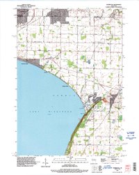
1992 Map of Sherwood
USGS Topo · Published 1996About this map
Lake Winnebago defines the western edge of this Calumet County region, where the limestone bluffs of High Cliff State Park overlook the shoreline. The landscape transitions from the recreational waters of Utowana Beach and Highland Beach to the established villages of Sherwood and Harrison. Local industry and heritage are visible through the documented Quarry sites and the historic Limekiln Ruins preserved along the lakefront.
Find a feature on this map
48 named features on this map. Tap any name to fly to it.
Don’t see what you’re looking for? This feature index may not catch every label — zoom into the map to look around manually.
Map Details
Editions of this 1992 Sherwood Map
This is the sole edition of this map. No revisions or reprints were ever made.
Other maps of this area

1911 · Neenah
USGS Topo · 1:62,500

1954 · De Pere
USGS Topo · 1:62,500

1954 · Chilton
USGS Topo · 1:62,500

1955 · Neenah
USGS Topo · 1:62,500

1955 · Appleton
USGS Topo · 1:24,000

1955 · Appleton
USGS Topo · 1:62,500

1955 · Neenah
USGS Topo · 1:24,000

1955 · Green Bay
USGS Topo · 1:250,000

1974 · Hilbert
USGS Topo · 1:24,000
1974 · Chilton
USGS Topo · 1:24,000