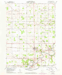
1960 Map of Sherwood
USGS Topo · Published 1973About this map
Maumee River curves through the southern portion of this region, joined by winding tributaries like Gordon Creek and Platter Creek. The village of Sherwood serves as a central hub, situated at the junction of the Penn Central railroad and an east-west rail line. This landscape is defined by its agrarian structure, with numerous family-named roads such as Mc Cavit Road, Blosser Road, and Openlander Road marking the township boundaries of Farmer, Washington, and Delaware.
Find a feature on this map
49 named features on this map. Tap any name to fly to it.
Don’t see what you’re looking for? This feature index may not catch every label — zoom into the map to look around manually.
Map Details
Editions of this 1960 Sherwood Map
2 editions found
Other maps of this area

1907 · Defiance
USGS Topo · 1:62,500

1909 · Defiance
USGS Topo · 1:62,500

1909 · Continental
USGS Topo · 1:62,500

1914 · Bryan
USGS Topo · 1:62,500

1914 · Paulding
USGS Topo · 1:62,500

1943 · Bryan
USGS Topo · 1:62,500

1944 · Paulding
USGS Topo · 1:62,500

1953 · Fort Wayne
USGS Topo · 1:250,000

1956 · Fort Wayne
USGS Topo · 1:250,000

1960 · Sherwood
USGS Topo · 1:24,000