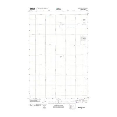
2011 Map of Sherwood
USGS Topo · Published 2011About this map
Sherwood stands as the primary hub of this Renville County landscape, situated just south of the international border. The settlement is defined by a grid of streets that transition into a sprawling network of agricultural roads, including County Rd-2 and Prairie Trl. The northern portion of the quadrangle is marked by the winding path of Cut Bank Creek, which provides a natural break in the otherwise systematic township and range section lines. Local life and history are anchored by landmarks such as the Union Cemetery and the Sherwood Golf Course, while the area's aviation needs are served by both the Sherwood Municipal Airport and the Haskins Landing Strip. This 2011 survey captures a quiet, rural community where the infrastructure of local travel, from 101st St NW to 109th St NW, supports a vast farming economy.
Find a feature on this map
21 named features on this map. Tap any name to fly to it.
Don’t see what you’re looking for? This feature index may not catch every label — zoom into the map to look around manually.
Map Details
Editions of this 2011 Sherwood Map
This is the sole edition of this map. No revisions or reprints were ever made.
Other maps of this area

1948 · Mohall
USGS Topo · 1:24,000

1949 · Mohall SW
USGS Topo · 1:24,000

1949 · Mohall NE
USGS Topo · 1:24,000

1949 · Sherwood
USGS Topo · 1:24,000

1949 · Mouse River Park NE
USGS Topo · 1:24,000

1949 · Mouse River Park
USGS Topo · 1:24,000

1950 · Mohall
USGS Topo · 1:62,500
1950 · Mouse River Park
USGS Topo · 1:62,500

1954 · Minot
USGS Topo · 1:250,000

1958 · Minot
USGS Topo · 1:250,000