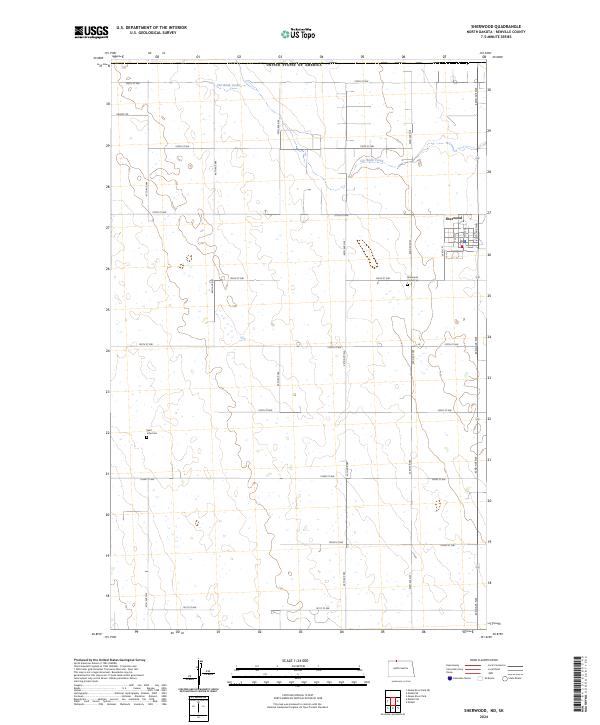
2024 Map of Sherwood
USGS Topo · Published 2024About this map
Sherwood stands as a focal point in this Renville County landscape, situated just south of the United States of America border. The town's grid is clearly delineated, featuring a concentrated street network including Main St, W 4th St, and W 2nd St. This rural North Dakota terrain is defined by the Public Land Survey System grid and the winding course of Cut Bank Creek, which meanders across the northern sections of the township. Local history and genealogy researchers will find key landmarks such as the Sherwood Union Cem located just south of the town center, and the more remote Saint John Cem to the west. The map also records contemporary transit routes like the Prairie Trl, illustrating the enduring intersection of international boundary lines and high plains agriculture.
Find a feature on this map
28 named features on this map. Tap any name to fly to it.
Don’t see what you’re looking for? This feature index may not catch every label — zoom into the map to look around manually.
Map Details
Editions of this 2024 Sherwood Map
This is the sole edition of this map. No revisions or reprints were ever made.
Other maps of this area

1948 · Mohall
USGS Topo · 1:24,000

1949 · Mohall SW
USGS Topo · 1:24,000

1949 · Mohall NE
USGS Topo · 1:24,000

1949 · Sherwood
USGS Topo · 1:24,000

1949 · Mouse River Park NE
USGS Topo · 1:24,000

1949 · Mouse River Park
USGS Topo · 1:24,000

1950 · Mohall
USGS Topo · 1:62,500
1950 · Mouse River Park
USGS Topo · 1:62,500

1954 · Minot
USGS Topo · 1:250,000

1958 · Minot
USGS Topo · 1:250,000