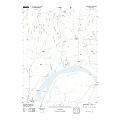
2011 Map of Shetlerville
USGS Topo · Published 2011About this map
The Ohio River forms a dominant sweep across this landscape, defining the transition from the Illinois uplands to the Kentucky shoreline. The riverfront is marked by Parkinson Landing and Rondeau Island, reflecting a history of river-dependent activity near the settlement of Shetlerville. In the northern interior, the land is heavily marked by small-scale mineral extraction, with a cluster of sites including the Shelby Mine, Sheldon Mine, and Baker Mine near the crossroads of Eichorn. This pattern of scattered mines suggests a regional economy built on local geology.
Find a feature on this map
67 named features on this map. Tap any name to fly to it.
Don’t see what you’re looking for? This feature index may not catch every label — zoom into the map to look around manually.
Map Details
Editions of this 2011 Shetlerville Map
This is the sole edition of this map. No revisions or reprints were ever made.
Other maps of this area

1916 · Golconda
USGS Topo · 1:62,500

1916 · Equality
USGS Topo · 1:62,500

1917 · Brownfield
USGS Topo · 1:62,500

1920 · Goloonda
USGS Topo · 1:48,000

1921 · Golconda
USGS Topo · 1:62,500

1925 · Harrisburg
USGS Topo · 1:62,500

1939 · Harrisburg
USGS Topo · 1:62,500

1949 · Paducah
USGS Topo · 1:250,000

1950 · Paducah
USGS Topo · 1:250,000

1954 · Paducah
USGS Topo · 1:250,000