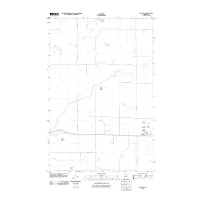
2010 Map of Shevlin
USGS Topo · Published 2010About this map
Shevlin sits at the junction of several county routes in this Northern Minnesota landscape, serving as a focal point for the surrounding rural area. The town is marked by essential civic features including the Shevlin Post Office and a cluster of nearby burial grounds, such as Landstad Cemetery and Our Lady of Victory Cemetery. This concentration of cemeteries, which also includes Shevlin Cemetery and Clearwater Cemetery, suggests a long-standing community with deep roots in the Clearwater County region.
Find a feature on this map
29 named features on this map. Tap any name to fly to it.
Don’t see what you’re looking for? This feature index may not catch every label — zoom into the map to look around manually.
Map Details
Editions of this 2010 Shevlin Map
This is the sole edition of this map. No revisions or reprints were ever made.
Other maps of this area

1919 · Solway
USGS Topo · 1:62,500

1943 · Solway
USGS Topo · 1:62,500

1943 · Bagley
USGS Topo · 1:62,500

1954 · Bemidji
USGS Topo · 1:250,000

1957 · Bemidji
USGS Topo · 1:250,000

1958 · Bemidji
USGS Topo · 1:250,000

1969 · Clearbrook
USGS Topo · 1:24,000

1969 · Leonard
USGS Topo · 1:24,000
1969 · Bagley
USGS Topo · 1:24,000

1969 · Shevlin
USGS Topo · 1:24,000