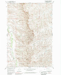
1960 Map of Shick Ranch
USGS Topo · Published 1985About this map
Rotten Grass Creek meanders through the western portion of this landscape within the Crow Indian Reservation, marking a terrain defined by complex coulees and seasonal drainages. The 1960 field data captures a quiet ranching environment where the Shick Ranch and Barber Ranch serve as the primary named hubs of activity. These operations rely on a network of drainages including Good Luck Creek, Park Creek, and Sunday Creek to manage livestock in an area otherwise characterized by its isolation. A single Jeep Trail in the south provides one of the few named interior transit routes, while Eychaner Coulee and Mission Coulee carve deep impressions into the western slopes. The map illustrates the fundamental relationship between water access and land use in Big Horn County, where named features almost exclusively follow the paths of ephemeral and perennial creeks.
Find a feature on this map
15 named features on this map. Tap any name to fly to it.
Don’t see what you’re looking for? This feature index may not catch every label — zoom into the map to look around manually.
Map Details
Editions of this 1960 Shick Ranch Map
2 editions found
Other maps of this area

1894 · Rosebud
USGS Topo · 1:125,000

1894 · St. Xavier
USGS Topo · 1:125,000

1901 · Rosebud
USGS Topo · 1:125,000

1901 · St. Xavier
USGS Topo · 1:125,000

1954 · Hardin
USGS Topo · 1:250,000

1957 · Hardin
USGS Topo · 1:250,000

1958 · Hardin
USGS Topo · 1:250,000

1960 · Schick Ranch
USGS Topo · 1:24,000

1960 · St Xavier
USGS Topo · 1:24,000

1960 · St Xavier NE
USGS Topo · 1:24,000