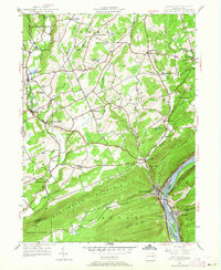
1954 Map of Shickshinny
USGS Topo · Published 1964About this map
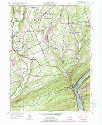
Shickshinny occupies a narrow strip between the base of Shickshinny Mountain and the Susquehanna River, where the borough's grid meets the water across from Mocanaqua. This 1954 revision of 1940s field data shows a landscape transitioning from the river-valley industry to the upland rural life of Luzerne and Columbia counties. Significant local landmarks include Huntington Mills on Huntington Creek and several rural educational sites like McKendree Sch and Waterton Sch. The northern terrain is dotted with small crossroads such as Harveyville and Bloomingdale, while family history is recorded at Fine Grove Cem and St Cashimirs Cem. High points along the ridges are marked by a Fire Tower overlooking the river gap, illustrating the topography that constrained development to the valleys and plateaus.
Find a feature on this map
51 named features on this map. Tap any name to fly to it.
Don’t see what you’re looking for? This feature index may not catch every label — zoom into the map to look around manually.
Map Details
Editions of this 1954 Shickshinny Map
5 editions found
Other maps of this area

1891 · Harveys Lake
USGS Topo · 1:62,500

1893 · Harvey Lake
USGS Topo · 1:62,500

1894 · Shickshinny
USGS Topo · 1:62,500

1894 · Bloomsburg
USGS Topo · 1:62,500

1934 · Laporte
USGS Topo · 1:62,500

1946 · Sybertsville
USGS Topo · 1:31,680

1946 · Nanticoke
USGS Topo · 1:31,680

1946 · Shickshinny
USGS Topo · 1:31,680

1946 · Berwick
USGS Topo · 1:31,680

1946 · Harveys Lake
USGS Topo · 1:24,000
Featured Places
- Hunlock Township, PA
- Conyngham Township, PA
- Shickshinny, PA
- Briar Creek Township, PA
- Muhlenburg, Union Township