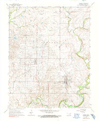
1964 Map of Shidler
USGS Topo · Published 1991About this map
Shidler and the neighboring settlements of Webb City and Lyman dominate this mid-century portrait of Osage County, Oklahoma. The landscape is heavily marked by industrial activity, with numerous Wells dotting the terrain between Lep and the surrounding rangeland, reflecting the regional dependence on resource extraction. The drainage patterns of Salt Creek and its tributaries, including Beaver Creek and Haines Creek, carve through the terrain, which is punctuated by topographical high points such as Foraker and Big Hill. Local infrastructure is captured through the presence of a Radio Tower, a Substation, and Gravel Pits near a Ford on the southern reaches of the creek system. This 1964 survey captures the area after its peak growth, showing the established grid of these small oil-field communities as they appeared decades ago.
Find a feature on this map
19 named features on this map. Tap any name to fly to it.
Don’t see what you’re looking for? This feature index may not catch every label — zoom into the map to look around manually.
Map Details
Editions of this 1964 Shidler Map
2 editions found
Other maps of this area

1916 · Foraker
USGS Topo · 1:62,500

1932 · Fairfax
USGS Topo · 1:62,500

1935 · Kaw
USGS Topo · 1:62,500

1936 · Belford
USGS Topo · 1:62,500

1955 · Enid
USGS Topo · 1:250,000

1958 · Enid
USGS Topo · 1:250,000

1964 · Charley Creek NE
USGS Topo · 1:24,000

1964 · Kaw City
USGS Topo · 1:24,000
1964 · Shidler
USGS Topo · 1:24,000
1964 · Hardy
USGS Topo · 1:24,000