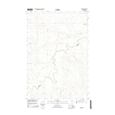
2014 Map of Shields
USGS Topo · Published 2014About this map
The Shields community sits in the northeastern corner of this landscape, positioned near the boundary where Grant Co meets Sioux Co. The most prominent natural feature is the winding path of the Cannonball River, which snakes across the southern and eastern portions of the map, carving a distinct valley through the prairie. This 2014 survey documents a sparsely populated rural region defined by a precise grid of sectional roads, including Cr-1934 and various numbered routes like 81st St SW and 36th Ave SW. The topography reflects the transition from flat upland plains to the more varied breaks and drainage basins associated with the river's course, illustrating the typical settlement patterns of the North Dakota plains during the early 21st century.
Find a feature on this map
18 named features on this map. Tap any name to fly to it.
Don’t see what you’re looking for? This feature index may not catch every label — zoom into the map to look around manually.
Map Details
Editions of this 2014 Shields Map
This is the sole edition of this map. No revisions or reprints were ever made.
Other maps of this area

1954 · Bismarck
USGS Topo · 1:250,000

1958 · Bismarck
USGS Topo · 1:250,000

1971 · Shields SW
USGS Topo · 1:24,000

1971 · Shields
USGS Topo · 1:24,000

1971 · Lookout Butte SE
USGS Topo · 1:24,000

1971 · Porcupine
USGS Topo · 1:24,000

1971 · Timmer
USGS Topo · 1:24,000

1971 · Pamplin Hills
USGS Topo · 1:24,000

1980 · Freda
USGS Topo · 1:24,000

1980 · Bell Coulee East
USGS Topo · 1:24,000