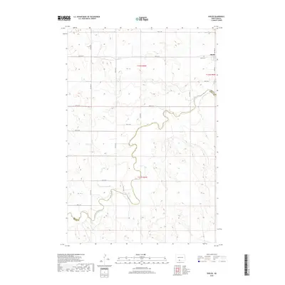
2018 Map of Shields
USGS Topo · Published 2018About this map
The Cannonball River meanders through this portion of the northern Great Plains, defining a natural corridor across the Grant Co Sioux Co line. The small community of Shields is situated in the northeastern corner of the map, serving as a primary point of reference for the surrounding rural area. Nearby, the Shields Cem provides a genealogical touchstone for local families. The landscape is characterized by a grid of rural routes, including 82nd St SW and 40th Ave SW, which navigate the elevation changes of the river valley. This 2018 survey captures the enduring rural structure of the region, where land divisions like t132n r84w and t131n r84w organize the open terrain.
Find a feature on this map
19 named features on this map. Tap any name to fly to it.
Don’t see what you’re looking for? This feature index may not catch every label — zoom into the map to look around manually.
Map Details
Editions of this 2018 Shields Map
This is the sole edition of this map. No revisions or reprints were ever made.
Other maps of this area

1954 · Bismarck
USGS Topo · 1:250,000

1958 · Bismarck
USGS Topo · 1:250,000

1971 · Shields SW
USGS Topo · 1:24,000

1971 · Shields
USGS Topo · 1:24,000

1971 · Lookout Butte SE
USGS Topo · 1:24,000

1971 · Porcupine
USGS Topo · 1:24,000

1971 · Timmer
USGS Topo · 1:24,000

1971 · Pamplin Hills
USGS Topo · 1:24,000

1980 · Freda
USGS Topo · 1:24,000

1980 · Bell Coulee East
USGS Topo · 1:24,000