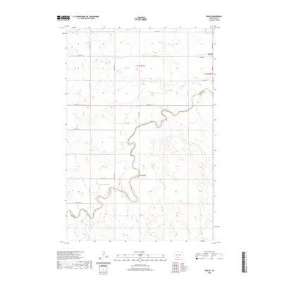
2020 Map of Shields
USGS Topo · Published 2020About this map
The Cannonball River carves a winding path through this corner of the Great Plains, defining the topography south of the small settlement of Shields. The town sits near the northeastern corner of the map, established along a grid of section-line roads such as 82nd St SW and 36th Ave SW. This 2020 edition provides a clear record of the local landscape where the border of Grant Co Sioux Co follows the river's meander in the southwest. For those researching family ties to this prairie community, the Shields Cem remains a primary landmark just south of the townsite. The surrounding land is marked by the systematic layout of townships t132n r84w and t131n r84w, showing a sparse but persistent network of rural infrastructure.
Find a feature on this map
19 named features on this map. Tap any name to fly to it.
Don’t see what you’re looking for? This feature index may not catch every label — zoom into the map to look around manually.
Map Details
Editions of this 2020 Shields Map
This is the sole edition of this map. No revisions or reprints were ever made.
Other maps of this area

1954 · Bismarck
USGS Topo · 1:250,000

1958 · Bismarck
USGS Topo · 1:250,000

1971 · Shields SW
USGS Topo · 1:24,000

1971 · Shields
USGS Topo · 1:24,000

1971 · Lookout Butte SE
USGS Topo · 1:24,000

1971 · Porcupine
USGS Topo · 1:24,000

1971 · Timmer
USGS Topo · 1:24,000

1971 · Pamplin Hills
USGS Topo · 1:24,000

1980 · Freda
USGS Topo · 1:24,000

1980 · Bell Coulee East
USGS Topo · 1:24,000