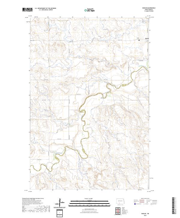
2024 Map of Shields
USGS Topo · Published 2024About this map
The Cannonball River carves a winding path across this portion of the Great Plains, serving as the primary geographic marker and political boundary between Grant Co and Sioux Co. The small settlement of Shields sits in the northeast corner, a quiet hub in an area defined by its sprawling section-line road network, including 36th Ave and 81st St SW. This 2024 survey captures the rural character of the landscape, where the elevation drops significantly toward the river valley. Genealogists and local historians can find the Shields Cem positioned just west of the townsite, providing a fixed point for family research in this sparsely populated region of North Dakota. The map's detail shows how modern infrastructure follows the traditional township and range divisions of t132n r84w and t131n r84w.
Find a feature on this map
20 named features on this map. Tap any name to fly to it.
Don’t see what you’re looking for? This feature index may not catch every label — zoom into the map to look around manually.
Map Details
Editions of this 2024 Shields Map
This is the sole edition of this map. No revisions or reprints were ever made.
Other maps of this area

1954 · Bismarck
USGS Topo · 1:250,000

1958 · Bismarck
USGS Topo · 1:250,000

1971 · Shields SW
USGS Topo · 1:24,000

1971 · Shields
USGS Topo · 1:24,000

1971 · Lookout Butte SE
USGS Topo · 1:24,000

1971 · Porcupine
USGS Topo · 1:24,000

1971 · Timmer
USGS Topo · 1:24,000

1971 · Pamplin Hills
USGS Topo · 1:24,000

1980 · Freda
USGS Topo · 1:24,000

1980 · Bell Coulee East
USGS Topo · 1:24,000