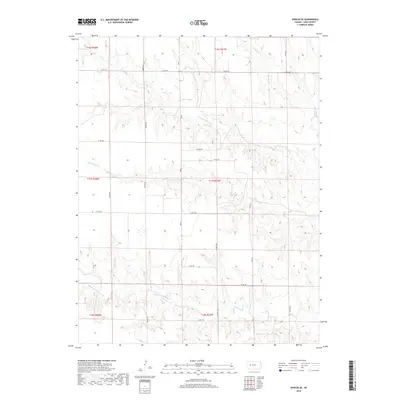
2018 Map of Shields SE
USGS Topo · Published 2018About this map
N Fork Walnut Cr and its various tributaries carve a series of deep drainages across this section of Lane County, defining a landscape shaped by intermittent water and high plains agriculture. The map reveals a highly structured grid of county roads, such as Co RD 240 and Co RD 200, which navigate the elevation changes between the creek beds and the level tablelands. Local naming conventions appear in secondary routes like Rowdy Rd, Turkey Red, and Vista Rd, suggesting a mix of personal history and descriptive geography. The drainage patterns of Cottonwood Cr and Wild Horse Cr illustrate the subtle, rugged erosion typical of the High Plains, where ranching and dryland farming footprints are visible in the layout of sections and township lines like t17s r27w.
Find a feature on this map
24 named features on this map. Tap any name to fly to it.
Don’t see what you’re looking for? This feature index may not catch every label — zoom into the map to look around manually.
Map Details
Editions of this 2018 Shields SE Map
This is the sole edition of this map. No revisions or reprints were ever made.
Other maps of this area

1955 · Scott City
USGS Topo · 1:250,000

1958 · Scott City
USGS Topo · 1:250,000

1965 · Beeler
USGS Topo · 1:24,000

1965 · Utica SW
USGS Topo · 1:24,000

1974 · Dighton
USGS Topo · 1:24,000

1974 · Alamota
USGS Topo · 1:24,000

1974 · Shields NW
USGS Topo · 1:24,000

1974 · Pendennis
USGS Topo · 1:24,000

1974 · Shields SE
USGS Topo · 1:24,000
1974 · Shields
USGS Topo · 1:24,000