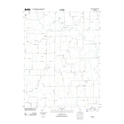
2012 Map of Shields
USGS Topo · Published 2012About this map
Skillet Fork and its numerous tributaries, including Paddy Creek and Possum Cr, define the drainage of this southern Illinois landscape near the settlements of Shields and Stratton. The map reveals a high density of family and community burial grounds, such as Jacob Chapel Cem, McConnaughhay Cem, and the uniquely named Ten Post Oak Cem, providing a rich resource for genealogical research. The region's 20th-century economic history is marked by energy extraction, visible through the Orchardville Oil Field and Coil Oil Field. In addition to the river crossings like Garrison Bridge and Gettins Bridge, the presence of Greathouse Ford indicates long-established transit points across the often-winding waterways. Terrain features like Little Potatoe Hill rise above the alluvial plains, while Horseshoe Slough illustrates the natural shifts in the river's course over time.
Find a feature on this map
114 named features on this map. Tap any name to fly to it.
Don’t see what you’re looking for? This feature index may not catch every label — zoom into the map to look around manually.
Map Details
Editions of this 2012 Shields Map
This is the sole edition of this map. No revisions or reprints were ever made.
Other maps of this area

1933 · Mount Vernon
USGS Topo · 1:48,000

1934 · Salem
USGS Topo · 1:62,500

1938 · Salem
USGS Topo · 1:62,500

1940 · Mount Vernon
USGS Topo · 1:62,500

1947 · Wayne City
USGS Topo · 1:62,500

1952 · Xenia
USGS Topo · 1:62,500

1958 · Belleville
USGS Topo · 1:250,000

1962 · Belleville
USGS Topo · 1:250,000

1964 · Opdyke
USGS Topo · 1:24,000

1965 · Iuka
USGS Topo · 1:24,000