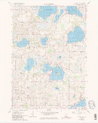
1960 Map of Shieldsville
USGS Topo · Published 1979About this map
Shieldsville sits at the heart of this post-war landscape, surrounded by an intricate chain of lakes and glacial depressions. The terrain is characterized by its density of water bodies, from the large expanse of French Lake and Cedar Lake to the smaller Willing Lake and Weinberger Lake. This 1960 field-checked survey reveals a rural society built around small community hubs, evidenced by several decentralized educational markers like Lake View Sch, Trebon Sch, and North Cedar Lake Sch.
Find a feature on this map
34 named features on this map. Tap any name to fly to it.
Don’t see what you’re looking for? This feature index may not catch every label — zoom into the map to look around manually.
Map Details
Editions of this 1960 Shieldsville Map
4 editions found
Other maps of this area

1953 · Saint Paul
USGS Topo · 1:250,000

1959 · Saint Paul
USGS Topo · 1:250,000

1960 · Faribault
USGS Topo · 1:24,000

1960 · Shieldsville
USGS Topo · 1:24,000

1960 · Lonsdale
USGS Topo · 1:24,000

1960 · Little Chicago
USGS Topo · 1:24,000

1962 · Morristown
USGS Topo · 1:24,000

1962 · Medford West
USGS Topo · 1:24,000

1966 · Montgomery
USGS Topo · 1:24,000

1966 · Waterville
USGS Topo · 1:24,000