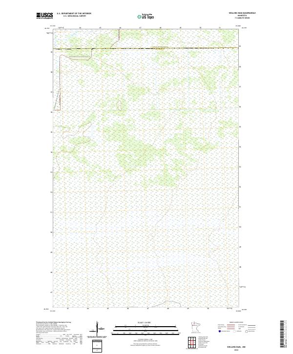
2022 Map of Shilling Dam
USGS Topo · Published 2022About this map
The Rapid River flows across the northern reaches of this remote landscape, marking a transition between the northern t157n r35w and t157n r34w townships. This 2022 survey documents a largely uninhabited expanse of wetlands and conservation land straddling the border of Lake of the Woods and Beltrami Counties. Human activity is primarily represented by the Consolidated Conservation Trails Trl and the Rapid River Rd NW, which provide the only significant access through this water-heavy terrain. The map captures the complex drainage patterns of northern Minnesota, where narrow waterways and extensive marshlands dictate the layout of the sparse road network.
Find a feature on this map
10 named features on this map. Tap any name to fly to it.
Don’t see what you’re looking for? This feature index may not catch every label — zoom into the map to look around manually.
Map Details
Editions of this 2022 Shilling Dam Map
This is the sole edition of this map. No revisions or reprints were ever made.
Other maps of this area

1918 · F
USGS Topo · 1:62,500

1919 · G
USGS Topo · 1:62,500

1919 · Ponemah
USGS Topo · 1:62,500

1943 · Ponemah
USGS Topo · 1:62,500

1954 · Roseau
USGS Topo · 1:250,000

1957 · Roseau
USGS Topo · 1:250,000

1958 · Roseau
USGS Topo · 1:250,000

1973 · Manomin Creek
USGS Topo · 1:24,000

1973 · Thorhult
USGS Topo · 1:24,000
1973 · Shilling Dam NW
USGS Topo · 1:24,000