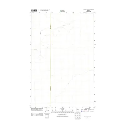
2013 Map of Shilling Dam NW
USGS Topo · Published 2013About this map
The boundary between Beltrami Co and Lake Of The Woods Co runs north-to-south through this northern Minnesota landscape. This 2013 survey depicts a sparsely developed region characterized by subtle topographical shifts and occasional wetlands. The primary human intervention in the area is Gladens Trl, a path that winds through the northern and western portions of the quadrangle. The lack of dense settlement or infrastructure suggests a landscape primarily dedicated to timber or conservation, maintaining its character well into the modern era.
Find a feature on this map
2 named features on this map. Tap any name to fly to it.
Don’t see what you’re looking for? This feature index may not catch every label — zoom into the map to look around manually.
Map Details
Editions of this 2013 Shilling Dam NW Map
This is the sole edition of this map. No revisions or reprints were ever made.
Other maps of this area

1918 · Winterroad
USGS Topo · 1:62,500

1918 · F
USGS Topo · 1:62,500

1918 · Malcolm
USGS Topo · 1:62,500

1954 · Roseau
USGS Topo · 1:250,000

1957 · Roseau
USGS Topo · 1:250,000

1958 · Roseau
USGS Topo · 1:250,000
1968 · Mulligan Lake
USGS Topo · 1:24,000
1969 · Winter Road Lake SE
USGS Topo · 1:24,000
1969 · Winter Road Lake SW
USGS Topo · 1:24,000

1973 · Gates Corner
USGS Topo · 1:24,000