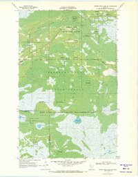
1969 Map of Winter Road Lake SW
USGS Topo · Published 1971About this map
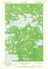
Norris Camp serves as a central hub in this landscape of managed wetlands and forests within the Beltrami Island State Forest. Established at the convergence of several routes, including the O'Brien Trail, this remote outpost is supported by the Norris Lookout Tower and the Norris Camp Landing Field. The map reveals a complex mosaic of conservation boundaries where the State Game Refuge meets the Red Lake State Wildlife Management Area, highlighting the region's importance for wildlife preservation in northern Minnesota.
Find a feature on this map
20 named features on this map. Tap any name to fly to it.
Don’t see what you’re looking for? This feature index may not catch every label — zoom into the map to look around manually.
Map Details
Editions of this 1969 Winter Road Lake SW Map
2 editions found
Other maps of this area

1918 · Winterroad
USGS Topo · 1:62,500

1918 · F
USGS Topo · 1:62,500

1918 · Malcolm
USGS Topo · 1:62,500

1954 · Roseau
USGS Topo · 1:250,000

1957 · Roseau
USGS Topo · 1:250,000

1958 · Roseau
USGS Topo · 1:250,000
1968 · Winter Road Lake
USGS Topo · 1:24,000
1968 · Mulligan Lake NE
USGS Topo · 1:24,000
1968 · Winter Road Lake NW
USGS Topo · 1:24,000
1968 · Mulligan Lake
USGS Topo · 1:24,000