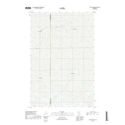
2019 Map of Shilling Dam NW
USGS Topo · Published 2019About this map
Low-lying wetlands and seasonal drainage patterns define this portion of the northern Minnesota landscape, situated along the border of Beltrami and Lake of the Woods counties. The terrain is characterized by a high concentration of marshy ground, punctuated by subtle elevation changes that are traversed by local access points like Moose River Rd NW and Gladens Trl. This 2019 survey documents a sparsely populated area where the natural environment remains the dominant feature, providing a clear view of the wilderness interface and the administrative boundaries that divide these northern territories. The road network is limited, reflecting the remote nature of the terrain and its primary use for resource management or seasonal access.
Find a feature on this map
7 named features on this map. Tap any name to fly to it.
Don’t see what you’re looking for? This feature index may not catch every label — zoom into the map to look around manually.
Map Details
Editions of this 2019 Shilling Dam NW Map
This is the sole edition of this map. No revisions or reprints were ever made.
Other maps of this area

1918 · Winterroad
USGS Topo · 1:62,500

1918 · F
USGS Topo · 1:62,500

1918 · Malcolm
USGS Topo · 1:62,500

1954 · Roseau
USGS Topo · 1:250,000

1957 · Roseau
USGS Topo · 1:250,000

1958 · Roseau
USGS Topo · 1:250,000
1968 · Mulligan Lake
USGS Topo · 1:24,000
1969 · Winter Road Lake SE
USGS Topo · 1:24,000
1969 · Winter Road Lake SW
USGS Topo · 1:24,000

1973 · Gates Corner
USGS Topo · 1:24,000