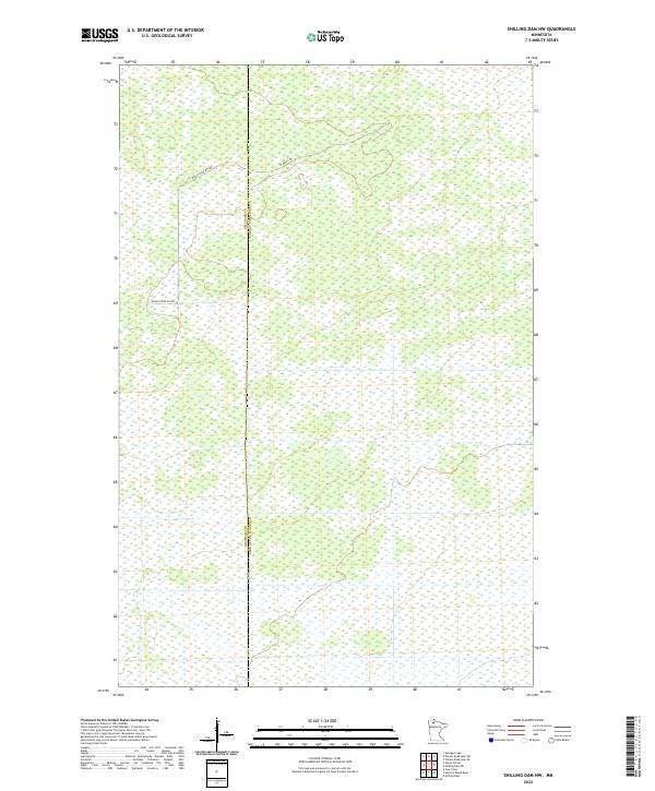
2022 Map of Shilling Dam NW
USGS Topo · Published 2022About this map
Wetlands and intricate water systems dominate this landscape along the border of Beltrami Co Lake of the Woods Co. This remote section of Northern Minnesota is characterized by its sparse infrastructure, defined primarily by the presence of Moose River Rd NW and Gladens Trl. The map illustrates a largely undeveloped wilderness where the natural hydrology and township boundaries, including t158n r36w and t157n r35w, provide the primary points of orientation. The lack of traditional settlements or industrial structures highlights the conservation and wilderness character of this region during the early 2020s.
Find a feature on this map
7 named features on this map. Tap any name to fly to it.
Don’t see what you’re looking for? This feature index may not catch every label — zoom into the map to look around manually.
Map Details
Editions of this 2022 Shilling Dam NW Map
This is the sole edition of this map. No revisions or reprints were ever made.
Other maps of this area

1918 · Winterroad
USGS Topo · 1:62,500

1918 · F
USGS Topo · 1:62,500

1918 · Malcolm
USGS Topo · 1:62,500

1954 · Roseau
USGS Topo · 1:250,000

1957 · Roseau
USGS Topo · 1:250,000

1958 · Roseau
USGS Topo · 1:250,000
1968 · Mulligan Lake
USGS Topo · 1:24,000
1969 · Winter Road Lake SE
USGS Topo · 1:24,000
1969 · Winter Road Lake SW
USGS Topo · 1:24,000

1973 · Gates Corner
USGS Topo · 1:24,000