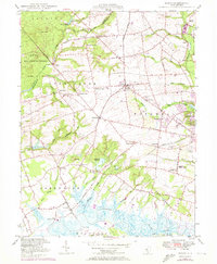
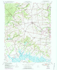
1947 Map of Shiloh
USGS Topo · Published 1972About this map
Marlboro Run and Stow Creek wind through a landscape defined by small crossroads settlements and early industrial sites in this mid-century survey of the Cumberland and Salem County border. The agricultural character of the region is anchored by local landmarks like the Seventh Day Mill and Mickles Mill, reflecting the milling heritage along the area's numerous runs and branches. Settlement patterns are focused around historic junctions such as Shiloh, Roadstown, and Greenwich, where the Town Hall and Marlboro Ch served as community hubs.
Find a feature on this map
80 named features on this map. Tap any name to fly to it.
Don’t see what you’re looking for? This feature index may not catch every label — zoom into the map to look around manually.
Map Details
Editions of this 1947 Shiloh Map
5 editions found
Other maps of this area

1890 · Salem
USGS Topo · 1:62,500

1890 · Bay Side
USGS Topo · 1:62,500

1890 · Bridgeton
USGS Topo · 1:62,500

1890 · Glassboro
USGS Topo · 1:62,500

1894 · Bay Side
USGS Topo · 1:62,500

1894 · Bridgeton
USGS Topo · 1:62,500

1898 · Salem
USGS Topo · 1:62,500

1898 · Glassboro
USGS Topo · 1:62,500

1899 · Vineland
USGS Topo · 1:125,000

1901 · Camden
USGS Topo · 1:125,000
Featured Places
- Bridgeton, NJ
- Fairfield Township, NJ
- Hopewell Township, NJ
- Quinton Township, NJ
- Lower Alloways Creek Township, NJ