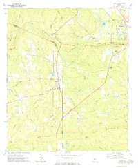
1971 Map of Shiloh
USGS Topo · Published 1973About this map
Pine Mountain and Oak Mountain dominate the geography of this West Georgia region, creating a natural corridor where the Southern and Seaboard Coast Line railroads converge near the town of Shiloh. The landscape is a transition between ridgelines and creek-fed valleys, with notable landmarks like Dowdell Knob and Hodo Gap marking the high ground. Small rural settlements and intersections such as Bulloch Crossroads and Nebula provide insight into the local community structure in the early 1970s.
Find a feature on this map
53 named features on this map. Tap any name to fly to it.
Don’t see what you’re looking for? This feature index may not catch every label — zoom into the map to look around manually.
Map Details
Editions of this 1971 Shiloh Map
2 editions found
Other maps of this area

1907 · Talbotton
USGS Topo · 1:125,000

1934 · Warm Springs
USGS Topo · 1:62,500

1936 · Warm Springs
USGS Topo · 1:62,500

1950 · Talbotton
USGS Topo · 1:24,000

1950 · Waverly Hall
USGS Topo · 1:24,000

1950 · Cataula
USGS Topo · 1:24,000

1950 · Talbotton
USGS Topo · 1:62,500

1950 · Ellerslie
USGS Topo · 1:62,500

1955 · Talbotton
USGS Topo · 1:24,000
1955 · Waverly Hall
USGS Topo · 1:24,000