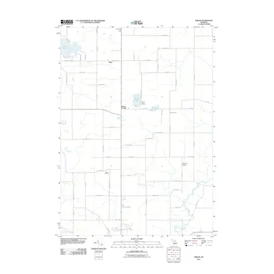
2011 Map of Shiloh
USGS Topo · Published 2011About this map
The community of Shiloh and the junction at Woods Corners anchor this rural landscape in Ionia County, defined by a classic grid of local roads and quiet water bodies. The terrain is marked by several significant burial sites, most notably the Ionia County Poor Farm Cemetery, which offers a poignant connection to the social history of the region. Other local landmarks like the Woodard Lake Cemetery, Snows Cemetery, and Higbee Cemetery are scattered throughout the township, serving as vital points of interest for those tracing family lineages. The natural landscape is shaped by the waters of Woodard Lake, Long Lake, and Bow Pond, with Prairie Creek winding through the eastern portion of the quadrangle. North of the primary settlement, the Hickory Hills Golf Course provides a modern recreational contrast to the surrounding agricultural and residential layout.
Find a feature on this map
58 named features on this map. Tap any name to fly to it.
Don’t see what you’re looking for? This feature index may not catch every label — zoom into the map to look around manually.
Map Details
Editions of this 2011 Shiloh Map
This is the sole edition of this map. No revisions or reprints were ever made.
Other maps of this area

1916 · Ionia
USGS Topo · 1:62,500

1918 · Ionia
USGS Topo · 1:62,500

1943 · Ionia
USGS Topo · 1:62,500

1945 · Portland
USGS Topo · 1:62,500

1954 · Midland
USGS Topo · 1:250,000

1958 · Midland
USGS Topo · 1:250,000

1958 · Grand Rapids
USGS Topo · 1:250,000

1959 · Midland
USGS Topo · 1:250,000

1961 · Grand Rapids
USGS Topo · 1:250,000

1962 · Grand Rapids
USGS Topo · 1:250,000
Featured Places
- Orleans Township, MI
- Ronald Township, MI
- Fairplain Township, MI
- Easton Township, MI
- Bushnell Township, MI