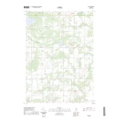
2023 Map of Shiloh
USGS Topo · Published 2023About this map
Shiloh serves as a central point in this landscape where the boundaries of Ionia and Montcalm counties meet. The area is defined by a dense network of country roads including N State Rd and Belding Rd, which connect scattered rural residences and farmsteads. Several historic burial sites, such as Woodard Lake Cem, Snows Cem, and Higbee Cem, are preserved across the townships, providing significant data points for genealogists tracing local families. The natural geography is shaped by water bodies like Long Lake and Woodard Lake, while Bellamy Creek and Prairie Creek drain the surrounding fields. Large tracts of land, including the Farm Service Agency Interest of Michigan, indicate specialized land management and conservation efforts in this agricultural region of Michigan.
Find a feature on this map
81 named features on this map. Tap any name to fly to it.
Don’t see what you’re looking for? This feature index may not catch every label — zoom into the map to look around manually.
Map Details
Editions of this 2023 Shiloh Map
This is the sole edition of this map. No revisions or reprints were ever made.
Other maps of this area

1916 · Ionia
USGS Topo · 1:62,500

1918 · Ionia
USGS Topo · 1:62,500

1943 · Ionia
USGS Topo · 1:62,500

1945 · Portland
USGS Topo · 1:62,500

1954 · Midland
USGS Topo · 1:250,000

1958 · Midland
USGS Topo · 1:250,000

1958 · Grand Rapids
USGS Topo · 1:250,000

1959 · Midland
USGS Topo · 1:250,000

1961 · Grand Rapids
USGS Topo · 1:250,000

1962 · Grand Rapids
USGS Topo · 1:250,000