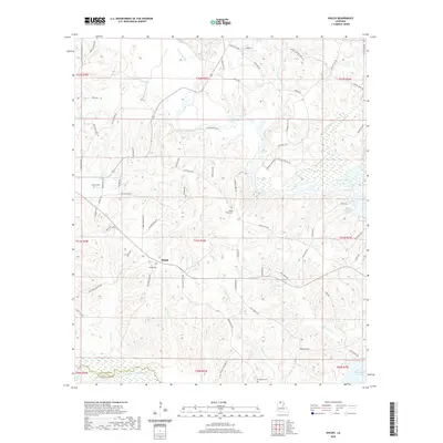
2020 Map of Shiloh
USGS Topo · Published 2020About this map
Shiloh centers a landscape defined by the branching tributaries of the Bayou D'Arbonne Lake system in northern Louisiana. This 2020 record illustrates a region where local geography is heavily influenced by the winding courses of Corney Bayou, Village Creek, and Tenmile Creek. The settlement pattern is characterized by scattered family-named cemeteries and crossroads, reflecting a long-standing rural community structure. Notable landmarks such as Shiloh Cemetery and Mount Patrick Cemetery serve as important touchstones for genealogical research, while the intersection of parish roads and historical points like Old Rockett Xing and Kays Lndg along the lakefront indicate the area's historical reliance on water-borne connectivity and timber-rich bottomlands. The northern boundary of Lincoln Parish meets Union Parish along the Middle Fork Bayou D'Arbonne, anchoring the survey's southern edge.
Find a feature on this map
80 named features on this map. Tap any name to fly to it.
Don’t see what you’re looking for? This feature index may not catch every label — zoom into the map to look around manually.
Map Details
Editions of this 2020 Shiloh Map
This is the sole edition of this map. No revisions or reprints were ever made.
Other maps of this area

1950 · Ruston
USGS Topo · 1:62,500

1951 · Ruston
USGS Topo · 1:62,500

1951 · Bernice
USGS Topo · 1:62,500

1952 · Calhoun
USGS Topo · 1:62,500

1952 · Farmerville
USGS Topo · 1:62,500

1955 · Shreveport
USGS Topo · 1:250,000

1956 · Shreveport
USGS Topo · 1:250,000
1982 · Downsville North
USGS Topo · 1:24,000

1984 · Shreveport
USGS Topo · 1:250,000

1985 · Monroe North
USGS Topo · 1:100,000