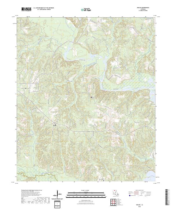
2024 Map of Shiloh
USGS Topo · Published 2024About this map
The settlement of Shiloh anchors this portion of northern Louisiana, where the landscape is defined by the winding course of Corney Bayou and its many tributaries. The area's history of river navigation and crossings is evident through landmarks like Lowrys Ferry and Kays Lndg, suggesting a time when these waterways served as primary transit corridors through the wooded terrain. In the southern reach, the Middle Fork Bayou D'Arbonne serves as a natural boundary near the line between Union Parish and Lincoln Parish.
Find a feature on this map
81 named features on this map. Tap any name to fly to it.
Don’t see what you’re looking for? This feature index may not catch every label — zoom into the map to look around manually.
Map Details
Editions of this 2024 Shiloh Map
This is the sole edition of this map. No revisions or reprints were ever made.
Other maps of this area

1950 · Ruston
USGS Topo · 1:62,500

1951 · Ruston
USGS Topo · 1:62,500

1951 · Bernice
USGS Topo · 1:62,500

1952 · Calhoun
USGS Topo · 1:62,500

1952 · Farmerville
USGS Topo · 1:62,500

1955 · Shreveport
USGS Topo · 1:250,000

1956 · Shreveport
USGS Topo · 1:250,000
1982 · Downsville North
USGS Topo · 1:24,000

1984 · Shreveport
USGS Topo · 1:250,000

1985 · Monroe North
USGS Topo · 1:100,000