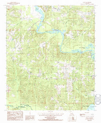
1985 Map of Shiloh
USGS Topo · Published 1986About this map
Shiloh sits at the heart of this North Louisiana landscape, where the topography is defined by the winding drainages of the Union Parish and Lincoln Parish border. In the mid-1980s, the area's hydrology was dominated by the expansive Bayou D'Arbonne Lake, which stretches across the eastern and southern portions of the sheet. This reservoir, along with the Lake D'Arbonne State Park, signifies the importance of water management and recreation in the region. The map reveals an intricate network of waterways, including Corney Bayou and Middle Fork Bayou D'Arbonne, which converge to feed the lake. For family historians, the inclusion of local Cem sites and the road named Edmonds provides specific points of interest for tracing early settlement patterns along the banks of Village Creek and Tenmile Creek.
Find a feature on this map
19 named features on this map. Tap any name to fly to it.
Don’t see what you’re looking for? This feature index may not catch every label — zoom into the map to look around manually.
Map Details
Editions of this 1985 Shiloh Map
This is the sole edition of this map. No revisions or reprints were ever made.
Other maps of this area

1950 · Ruston
USGS Topo · 1:62,500

1951 · Ruston
USGS Topo · 1:62,500

1951 · Bernice
USGS Topo · 1:62,500

1952 · Calhoun
USGS Topo · 1:62,500

1952 · Farmerville
USGS Topo · 1:62,500

1955 · Shreveport
USGS Topo · 1:250,000

1956 · Shreveport
USGS Topo · 1:250,000
1982 · Downsville North
USGS Topo · 1:24,000

1984 · Shreveport
USGS Topo · 1:250,000

1985 · Monroe North
USGS Topo · 1:100,000