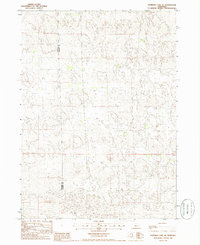
1985 Map of Shimmins Lake NE
USGS Topo · Published 1986About this map
Nebraska's Sandhills region, specifically the borderlands between Hooker Co and Thomas Co, is defined by a repetitive, rolling landscape of sand dunes and depressions. This 1980s-era topographical survey captures the remote and sparsely developed character of the central part of the state, where few permanent landmarks exist beyond the county line itself. The map reveals an intricate network of wind-shaped terrain and small, unnamed seasonal ponds, illustrating the delicate hydrology of the Ogallala Aquifer as it meets the surface. Without significant settlements or major roads, the area reflects a landscape primarily dedicated to large-scale ranching, where the natural contours of the land dictate the placement of unimproved ranch roads and property boundaries.
Find a feature on this map
1 named feature on this map. Tap any name to fly to it.
Don’t see what you’re looking for? This feature index may not catch every label — zoom into the map to look around manually.
Map Details
Editions of this 1985 Shimmins Lake NE Map
This is the sole edition of this map. No revisions or reprints were ever made.
Other maps of this area

1948 · Seneca
USGS Topo · 1:62,500

1948 · Thedford
USGS Topo · 1:62,500

1948 · Seneca 4
USGS Topo · 1:62,500

1949 · Seneca 4
USGS Topo · 1:62,500

1950 · Thedford
USGS Topo · 1:62,500

1950 · Shimmins Lake
USGS Topo · 1:62,500

1951 · Seneca
USGS Topo · 1:62,500

1954 · North Platte
USGS Topo · 1:250,000

1956 · North Platte
USGS Topo · 1:250,000

1957 · North Platte
USGS Topo · 1:250,000