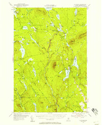
1954 Map of Shin Pond
USGS Topo · Published 1958About this map
Seboeis Farm and the Seboeis Fish and Game Club Camps sit at the heart of this mid-century Maine woodland, where the economy was defined by timber and recreation. This survey captures the intricate water systems of Penobscot County, including the Seboeis River and the expansive Upper Shin Pond. Industrial transport is noted by the presence of the American Thread Company Road, signaling the active logging operations of the 1950s. The landscape is marked by landmarks like Mount Chase and Snowshoe Mtn, while more remote outposts like Bowlin Camps and the Forest Service Camp provide evidence of early forest management and sporting life. Researchers will find a network of logging trails and "tote roads" connecting various deadwaters and rips, illustrating how the wilderness was navigated before modern infrastructure reached this part of the Maine North Woods.
Find a feature on this map
88 named features on this map. Tap any name to fly to it.
Don’t see what you’re looking for? This feature index may not catch every label — zoom into the map to look around manually.
Map Details
Editions of this 1954 Shin Pond Map
4 editions found

Other maps of this area

1927 · Katahdin
USGS Topo · 1:48,000

1930 · Katahdin
USGS Topo · 1:62,500

1940 · Island Falls
USGS Topo · 1:62,500

1940 · Sherman
USGS Topo · 1:62,500

1940 · Oxbow
USGS Topo · 1:62,500

1942 · Island Falls
USGS Topo · 1:62,500

1942 · Oxbow
USGS Topo · 1:62,500

1942 · Sherman
USGS Topo · 1:62,500

1949 · Katahdin
USGS Topo · 1:62,500

1953 · Stacyville
USGS Topo · 1:62,500